

Great Orme [Y Gogarth]
Good walks are even better shared.
SH7683 : Flush Bracket Bench Mark, Great Orme Trig Pillar
Mark Anderson Photo source
Overview
Great Orme (Y Gogarth) is the 207.1 m limestone headland northwest of Llandudno, with open grassland, sea cliffs and views towards Eryri and Anglesey. Waymarked paths climb from the town to the summit, while Marine Drive follows the coast below. Bronze Age copper mines, wildflowers and grazing goats add interest to this exposed coastal hill.
Great Orme [Y Gogarth]
Great Orme is a 207.1 m limestone headland northwest of Llandudno. It combines coastal views, open grassland and a long human history. Little Orme, on the opposite side of Llandudno Bay, is a separate 141 m hill.
Summit and landscape
The highest recorded point is a rock 2 m west of the trig point. In clear weather the summit and surrounding paths offer views towards Eryri, Anglesey and the north Wales coast. Carboniferous limestone, locally altered to dolomite, supports flower-rich grassland and areas of limestone pavement. Leave fossils in place and give grazing sheep and goats space.
Choosing a walk
The council's waymarked summit trails are distinct routes. Happy Valley climbs from Prince Edward Square beside the pier via the ski slope and St Tudno's Church. Haulfre Gardens uses stepped paths and streets, then passes the copper mines. Their published distances and times describe one-way ascents, so allow separately for the return.
The Zig Zag Trail is the steepest marked summit option. Its quoted trail length begins at the first waymarker on Invalids' Walk; approaches from the pier or West Shore add distance. Use the council's current trail map and local waymarkers.
The Nature Trail starts and finishes at the summit car park and has shorter and longer variants. Marine Drive provides a coastal circuit below the summit, with a return through Llandudno or via Haulfre Gardens. A separate Wales Coast Path itinerary follows its pavement from the Rest and Be Thankful café to West Shore. Neither coastal walk automatically visits the summit.
History and conservation
The copper mines are best known for their extensive Bronze Age workings. They lie lower down the hill near the tramway's Halfway Station. Later mining resumed in the late 17th century and continued into the 19th. St Tudno's Church, medieval farming remains and a Second World War artillery-school site add other layers of history.
The name Orme is thought to refer to a sea serpent in Old Norse. Conwy manages the Country Park and Local Nature Reserve. National Trust's Parc Farm is a working farm within the wider headland; its permissive paths can close temporarily. The summit visitor facilities are separately managed.
Practicalities and safety
Llandudno offers rail connections, parking and supplies. There are pay-and-display car parks at the summit and on St Tudno Road. The tramway operates seasonally from Victoria Station; check its latest timetable and last return. Summit visitor facilities have seasonal opening, so carry your own essentials.
The low altitude does not remove the risks of strong wind, steep slopes, slippery limestone and major cliff drops. Stay on established paths and pavements, take care at road and tramway crossings and keep dogs controlled around livestock. Avoid cliff shortcuts and animal tracks. In poor weather choose a less exposed walk. The small western Gogarth Nature Reserve has no paths and is best viewed from Marine Drive above.
Explore routes near Great Orme [Y Gogarth]
Walks starting near this hill. Open a route to check its map, distance and full itinerary.
Llyn Crafnant: Lakeside Circuit from the NRW Car Park
View route
Dyserth to Prestatyn: old railway walkway return
View route
Snowdon Pyg Track returning by Miner's Track
View route
Beddgelert Forest: Derwen Circuit and Llyn Llywelyn
View route
Route planning notes
These notes describe possible approaches. Check a route's map and access information when planning your walk.
Marine Drive circuit via West Shore and Haulfre Gardens
Start at Llandudno's North Shore promenade near the pier, follow Marine Drive around the headland to West Shore, then return via the steep approach to Invalids' Walk and Haulfre Gardens. This coastal circuit stays below the summit. Use the pavement and watch for traffic. Distance and duration depend on the precise promenade start and the chosen return through town; plan the complete circuit before setting out.
Happy Valley summit trail from Prince Edward Square
Follow the blue waymarkers from Prince Edward Square beside the pier, through Happy Valley, beside the ski slope and via St Tudno's Church to the summit. The council's approximate distance and time cover the one-way ascent only; arrange a return on foot or check seasonal transport. Steep sections and open, exposed ground make this more than a gentle promenade walk.
Great Orme Nature Trail, Route A
Follow the council's shorter waymarked nature circuit from and back to the summit car park (SH765833). The figures describe the full Route A loop, with uneven grassy and stony ground, steep sections and a pavement section beside Marine Drive. Allow time for the numbered nature stops. The alternative Route B is approximately 6.5 km and 3 hours; do not mix its figures with Route A.
Haulfre Gardens summit trail from Prince Edward Square
From Prince Edward Square, pass the Victoria Tramway Station and follow the olive-green summit trail through Haulfre Gardens, stepped paths and streets, then Pyllau Road past the copper mine entrance to the summit. The council's approximate distance and time are for the one-way ascent; add the descent or arrange seasonal transport. This is the easiest of the three marked summit trails but still includes steep, uneven sections.
Rest and Be Thankful café to West Shore via Marine Drive
From the café car park, turn right and follow the Marine Drive pavement to West Shore promenade, as described by the Wales Coast Path. This is a linear coastal road walk below the summit, not a western clifftop scramble. Return along the same pavement or plan onward transport. The published distance is approximately 4 km one way; the return adds the same distance. Allow additional time for the return or an onward connection. Keep to the pavement and stay back from cliff edges.
Make a day of it, together
Find someone to share the walk with, or organise a day out along a route you like.
Photo Gallery
View all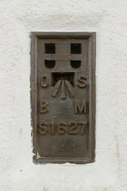 Photo could not load
SH7683 : Flush Bracket Bench Mark, Great Orme Trig Pillar
Mark Anderson
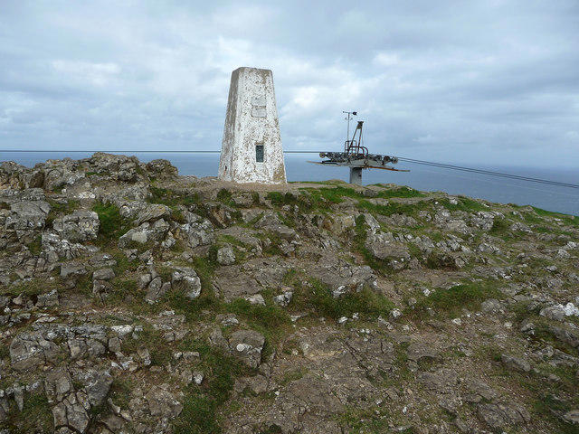 Photo could not load
SH7683 : Trig pillar and cable car pylon, summit of the Great Orme
Phil Champion
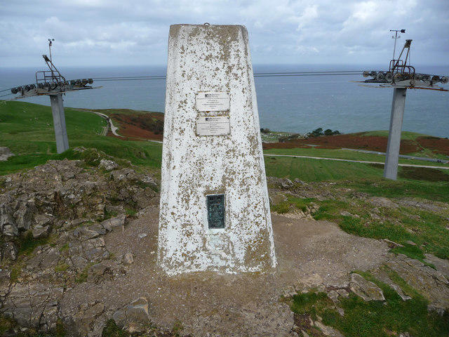 Photo could not load
SH7683 : Trig pillar and cable car pylons, summit of the Great Orme
Phil Champion
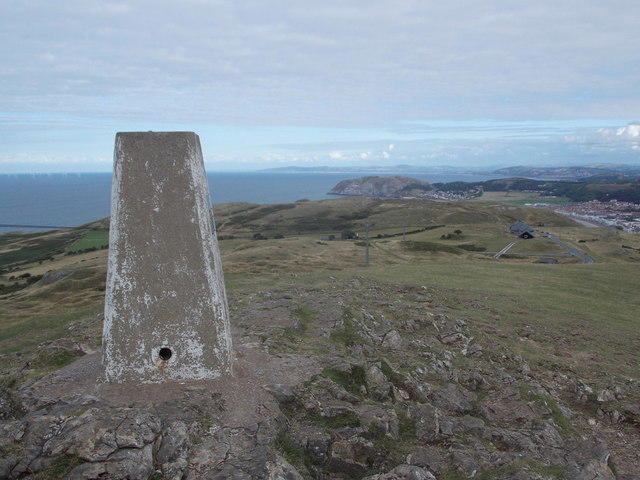 Photo could not load
SH7683 : Llandudno: trig point atop Great Orme
Chris Downer
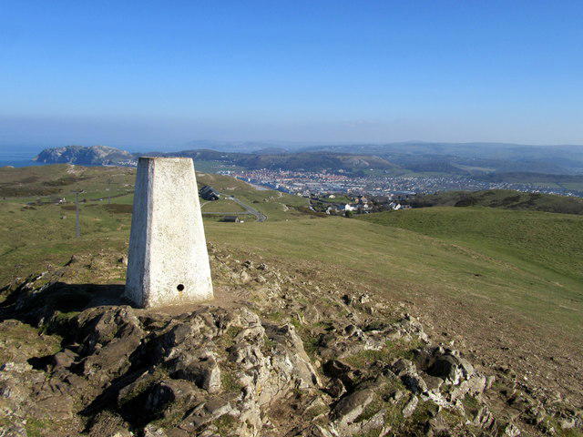 Photo could not load
SH7683 : Trig point on the Great Orme
John H Darch
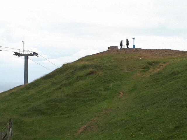 Photo could not load
SH7683 : Summit of the Great Orme
Stephen Craven
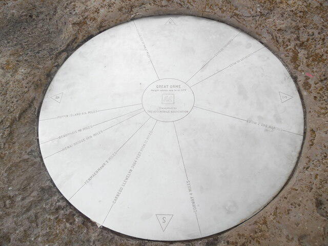 Photo could not load
SH7683 : Topograph on the summit of Great Orme
David Hillas
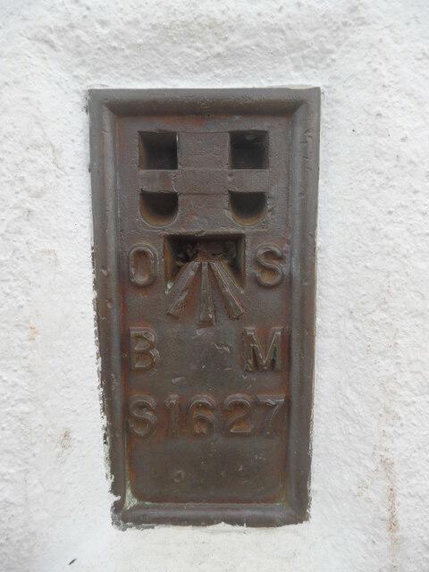 Photo could not load
SH7683 : Benchmark on the Triangulation Station on the Great Orme
David Hillas
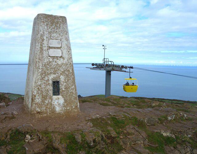 Photo could not load
SH7683 : Great Orme trig pillar
michael ely
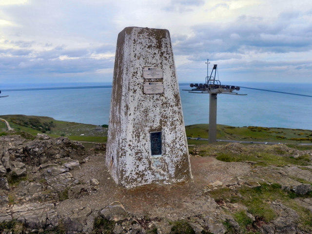
SH7683 : Great Orme Summit
David Dixon
Hill facts and local notes
Classifications
Elevation
207m
679 ft
Prominence
201m
Coordinates
53.3325, -3.8523
SH767833
OS Map
115
Explorer: OL17E
At the Summit
The recorded highest point is a rock 2 m west of the trig point. The broad summit area includes the Summit Complex, tram terminus and Country Park visitor centre. The Bronze Age copper mines are lower down the hill, near the tramway Halfway Station.
Terrain & Geology
Carboniferous limestone, including Visean rocks formed around 330 million years ago, makes up the headland. Some limestone has been altered to dolomite. Fractures and faults carried mineral-rich fluids that deposited copper minerals, explaining the long mining history. Fossil-bearing limestone and limestone pavement are notable features; leave fossils and rocks in place.
Views & Scenery
In clear weather there are views across Llandudno Bay and Little Orme, towards the Carneddau and other Eryri (Snowdonia) mountains, and across the Menai Strait to Anglesey and Puffin Island. The open coast also overlooks the Irish Sea and Liverpool Bay.
Best Seasons
Spring and early summer bring flowers to the limestone grassland; sunny, calmer summer days can be good for butterflies. Seabirds and grazing goats may be seen, but sightings and distant views depend on conditions. Observe wildlife from established paths without approaching cliff edges.
History & Heritage
Name Origin
The English name Orme is thought to come from an Old Norse word for a serpent or sea monster, referring to the headland's appearance from the sea. Its Welsh name is Y Gogarth.
Historical Significance
The Great Orme preserves prehistoric settlement remains and extensive Bronze Age copper workings. Large-scale mining resumed in the late 17th century and continued into the 19th. St Tudno's Church and medieval farming traces add to the landscape's history, while remains of a Second World War coast artillery school survive on the western side.
Getting There & Facilities
Parking
Pay-and-display parking is available at the Summit Complex and on St Tudno Road. These are not National Trust car parks. For a full ascent from town, use signed public parking in Llandudno and walk to the chosen trailhead. Summit access roads are steep and narrow; check local signs, charges and any restrictions.
Public Transport
Llandudno railway station serves the town; walk onwards to the pier area or chosen trailhead. The Great Orme Tramway runs from Victoria Station on Church Walks to the summit via Halfway Station, normally March to early November. Check current operating dates and last departures. Summit bus services vary by season; check current Traveline Cymru timetables rather than assuming a year-round service.
Nearby Facilities
The summit area has a visitor centre, toilets, refreshments, shop and playground, with further services in Llandudno. The Summit Complex and its parking are separate from the National Trust's Parc Farm. Opening arrangements vary by operator and season, and summit cafés or toilets may be closed in winter. Carry drinks and food and check opening times before relying on a facility.
Safety Information
Known Hazards
- Steep paths, steps and uneven limestone can be slippery when wet; wear footwear with good grip.
- Sea cliffs and quarry edges have serious drops. Stay on established paths, keep back from edges and do not follow animal tracks or attempt cliff shortcuts.
- The open headland is exposed to strong wind and rapidly changing weather, even when Llandudno feels sheltered.
- Marine Drive carries traffic; use its pavement where provided and take care at road and tramway crossings.
- Sheep and goats graze the headland. Keep dogs on a lead around livestock, give animals space and follow local signs.
Seasonal Hazards
Strong winter winds, short daylight and ice can make exposed paths more serious. Check the forecast and leave time for the return journey. Do not depend on seasonal summit transport or facilities being available. Respect temporary closures of permissive paths at the working Parc Farm, including during lambing or farm works.
General Safety Tips
- Check weather conditions before setting out
- Carry appropriate clothing and equipment
- Let someone know your planned route
- Take a map, compass, and GPS device
- Carry emergency supplies: food, water, first aid kit, torch
Hills
Some common questions about the hills answered
Are there group walks up Great Orme [Y Gogarth]?
Many walkers use Walkmates to join or organise walks with others. You can check for group walks around Great Orme [Y Gogarth] through the maps
Are there other walkers around Great Orme [Y Gogarth]?
Activity varies by location and time, but Walkmates lets you see whether others have shared walks or shown interest in this area. Find other people through the walking friends search walking friends for Great Orme [Y Gogarth] search or of course create your own walk for Great Orme [Y Gogarth]
Can I organise a walk to Great Orme [Y Gogarth]?
Yes. If there aren’t any walks listed already, you can create a walk and make it available for others to join.
If you're signed up to Walkmates, you can create a walk to Great Orme [Y Gogarth].
How do I find a walk up this hill?
There are often multiple ways to walk this hill, depending on experience and route preference. Walkmates helps you explore walks and routes that others have shared.
Can I suggest a new route up Great Orme [Y Gogarth]?
Yes. You can suggest or create routes to share with others. Walkmates focuses on the social side of walking, so routes are used to help people organise walks and explore areas together, rather than as detailed navigation tools or route libraries.
Other uses really appreciate knowledgeable walkers sharing their routes. Share your favourite route to Great Orme [Y Gogarth] here
The is an error or something incorrect about this hill. How do I let you know?
We always strive to keep the information on Walkmates as accurate as possible. If you find an error, please let us know through the contact form and we'll aim to correct it as quickly as possible
Community Discussion
Comments
Location
![Great Orme [Y Gogarth] location map](https://cdn.walkmates.com/hill-maps/hill-sources/2052/53.33254_-3.85228.png)
Grid reference: SH767833
View on OpenStreetMapOpens a map in a new tab, centred on the hill.
No comments yet. Be the first.